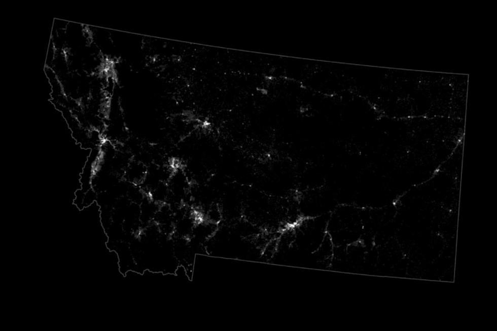
Cool Montana Map: Each Dot of Light Represents a Person
Most of us have probably seen those nighttime maps, taken from space, that show how lit-up certain parts of the country are. For example, this link shows the massive amount of light generated by oil rigs in the Bakken of North Dakota, lighting up the night sky.
At first glance, the images seen in this story look similar, but they're not images captured from space, nor do the white dots represent actual light. They represent people.
Each dot of light represents one person.
Dr. Nathan Yau operates the website FlowingData and he's been using visualization to represent data for over a decade. For these pictures, he downloaded 2020 US Census data into a software program called R to overlay the dots on a map of the US.
In the above image of Iowa (where I was born), you can see how the dots of light are almost grid-like. That's because, in Iowa, nearly every road runs almost straight north/south and east/west and that's where the towns are.
Not a lot of dots in Montana.
The image of the Treasure State is interesting to me. You can see the string of small lights across the Hi-Line and it's pretty easy to pick out Missoula, Billings, Kalispell, Helena and Great Falls. Then, there's the large block of very few dots in the middle of the state. There's Lewistown, then nothing but fairly sparse dots for hundreds of square miles. That's not necessarily a bad thing, in my opinion.
If you digs stats in a visual format, check out FlowingData.com. I enjoyed clicking through the larger images of all 50 states and prints are available. Thanks Nathan Yau for letting me share your images.
LOOK: Here are the pets banned in each state
More From Cat Country 102.9


