

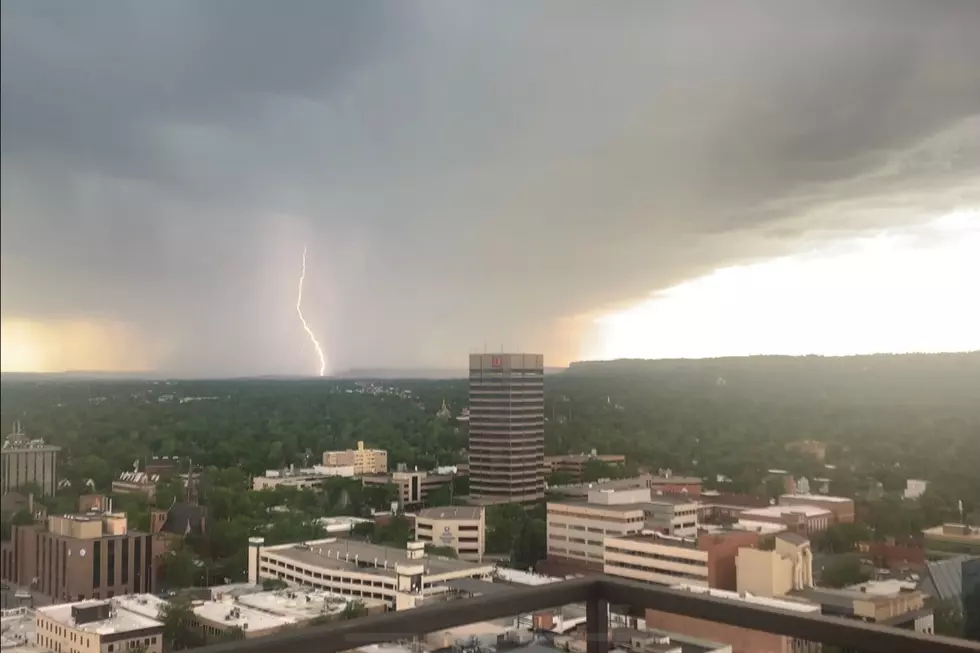
Forecasters Anticipate Potentially Severe Weather for Billings Area
Meteorologists are anticipating potentially severe storm activity across much of central and southcentral Montana, beginning Friday (6/13) afternoon, with another round possible into Saturday afternoon.
Early indicators reveal a slight chance of tornado activity, an ominous reminder of the devastating 2010 Father's Day tornado that destroyed MetraPark. Earlier today, Sheridan County posted a heads-up on its official Facebook page, noting an increased chance of tennis ball-sized hail, damaging winds over 75 MPH, and possible flash flooding.
Trending: What To Expect At The Revived Rockin' the Rockies Festival
The National Weather Service in Billings has issued a Severe Thunderstorm Watch until 9 PM Friday for 27 counties, including Yellowstone, Big Horn, Carbon, Musselshell, Custer, Stillwater, and others. A chance of storms is possible again on Saturday across much of the state.
Montana summers are often beautiful, but they can also bring a wild mix of severe weather. We may not deal with hurricanes or coastal storms, but Big Sky Country has its brand of summer fury.
Thunderstorms are the most common threat, often popping up quickly on hot afternoons. These storms can unleash intense lightning, heavy rain, hail, and strong wind gusts that can knock down trees or damage roofs and crops. Hailstones in Montana aren’t always pea-sized either—some storms have produced golf ball- to baseball-sized hail, especially east of the Divide.
Montana's Most Affordable Places To Live In 2025
Gallery Credit: jessejames
LIST: Montana's Best Supper Clubs
Gallery Credit: mwolfe
More From Cat Country 102.9


